


Geographic Information System
Description de Geographic Information System
The app is a complete free handbook of Geographic Information System- GIS which covers important topics, notes, materials & news on the course. Download the App as a reference material & digital book for Civil & other engineering programs & degree courses.
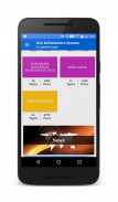
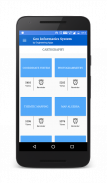
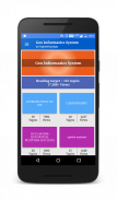
This useful App lists 100 topics with detailed notes, diagrams, equations, formulas & course material, the topics are listed in 5 chapters. The app is must have for all the engineering science students & professionals.
The app provides quick revision and reference to the important topics like a detailed flash card notes, it makes it easy & useful for the student or a professional to cover the course syllabus quickly just before an exams or job interviews.
Also get the hottest international engineering & technology news on your app powered by Google news feeds. We have customised it so that you get regular updates on the subject from international/national colleges, universities, research, industry, applications, engineering, tech, articles & innovation.
This is the best application to remain updated on your fav. subject.
Use this useful engineering app as your education tool, utility, tutorial, book, a reference guide for syllabus and explore study course material, aptitude tests & project work.
Track your learning, set reminders, edit, add favourite topics, share the topics on social media.
Some of the topics Covered in this application are:
1. INTRODUCTION OF GIS
2. GIS to Geocomputation
3. Technological Facilitation
4. BASIC FUNCTIONALITY OF GIS
5. A SYSTEM DEFINITION OF GIS
6. GIS Science and the Rise of Geo-Information Engineering
7. GIS SCIENCE TO FOLLOW
8. ISSUES OF GISCIENCE AS SELECTIVE GROUPING OF ASPECTS
9. INTRODUCTION OF CARTOGRAPHY
10. GEOINFORMATION TECHNOLOGY AND CARTOGRAPHY
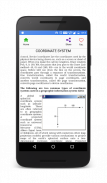
11. COORDINATE SYSTEM
12. GLOBAL SYSTEMS
13. PROJECTION BASICS FOR GIS PROFESSIONALS
14. MAP SCALE
15. MAP PROJECTION
16. GEOMETRIC TRANSFORMATION
17. VECTOR AND RASTER DATA
18. SAPATIAL PHENOMENON OF GIS
19. SPATIAL DATA FUNCTION
20. DATA COLLECTION TECHNOLOGIES
21. REMOTE SENSING
22. GROUND SURVEY
23. The Role and Nature of Environmental Models
24. CONTEXT OF ENVIRONMENTAL MODELLING
25. A SUMMARY OF MODEL DEVELOPMENT
26. APPLYING MODELS
27. MODELLING LANDSLIDES
28. MODELLING TOPOGRAPHY
29. TYPOLOGY OF MODELS
30. APPROACHES TO MODELLING
31. REPRESENTATION AND COMPUTATION OF GEOGRAPHIC DYNAMICS
32. TEMPORAL MODELLING
33. TEMPORAL GIS
34. DATABASE CONCEPTS
35. DATABASE DESIGN
36. DATA INPUT TECHNIQUES
37. DATA ENCODING
38. GLOBAL POSITIONING SYSTEM(GPS)
39. COMPARISON OF ENCODING AND DECODING
40. MAP LAYOUTS
41. MAP LAYOUTS ELEMENTS
42. COMPLETING MAPS AND SEQUENCES
43. SEQUENCING TECHNOLOGIES
44. MAPPING TECHNOLOGY
45. EVALUATING MODELS
46. MAP ALGEBRA
47. MAP ELGEBRA INPUT TYPES
48. OVERLAY ANALYSIS
49. VECRTOR AND RASTER OVERLAY
50. TARAIN MODELLING
51. SPATIAL INTERPOLATION
52. TRANSFER FUNCTION
53. GIS & ARTIFICIAL NEURAL NETWORKS
54. NETWORKS
55. GIS AND NETWORK ANALYSIS
56. WATER RESOURCE APPLICATIONS OF GIS
57. HYDROLOGIC MODELLING
58. GIS AND SOCIETY
59. GIS AND TRANSPORTATION
60. GIS BASED ASSESSMENT OF GEOTECHNICAL CHARACTIRISTICS
61. GEOTECHNICAL STRUCTURES
62. SPATAIL DATA GENERILAZTION IN GIS
63. WEB MAPPING
64. IMPORTANCE OF WEB BASED DESIGN
65. ENVIRONMENTAL IMPACT ANALYSIS
66. MAP SERVICE
67. ESTABLISHMENT AND DEVELOPMENT OF EFA MONITORING SYSTEMS
68. GIS IN UTILITY MANAGEMENT
69. THEMTIC MAPPING
70. Restructured-Accelerated Power Development and Reforms Programmed
71. GIS IN UTILITY MANAGEMENT
72. THEMTIC MAPPING
73. Restructured-Accelerated Power Development and Reforms Programmed
74. PHOTOGRAMMETRY
75. MOBILE MAPPING
Each topic is complete with diagrams, equations and other forms of graphical representations for better learning and quick understanding.
GIS is part of Civil & other engineering education courses and technology degree programs of various universities.
L'application est un guide complet et gratuit de l'information géographique System- SIG qui couvre des sujets importants, notes, matériaux et nouvelles sur le parcours. Téléchargez l'application en tant que matériau de référence et livre numérique pour les programmes civils et autres ingénieurs et cursus.
Cette application utile répertorie les 100 sujets avec des notes détaillées, des diagrammes, des équations, des formules et le matériel de cours, les sujets sont répertoriés dans 5 chapitres. L'application est indispensable pour tous les étudiants et les professionnels des sciences de l'ingénieur.
L'application fournit une révision rapide et référence aux sujets importants comme une des notes détaillées de cartes flash, il est facile et utile pour l'étudiant ou un professionnel pour couvrir le programme du cours rapidement juste avant un examen ou un entretien d'embauche.
Prenez également le plus chaud d'ingénierie et de la technologie des nouvelles internationales sur votre application powered by Google nouvelles RSS. Nous avons personnalisé afin que vous obtenez des mises à jour régulières sur le sujet de l'international / national des collèges, des universités, de la recherche, l'industrie, les applications, l'ingénierie, la technologie, des articles et l'innovation.
Ceci est la meilleure application pour rester à jour sur votre fav. assujettir.
Utilisez cette application d'ingénierie utile comme outil d'éducation, des services publics, tutoriel, livre, un guide de référence pour les syllabus et d'explorer le matériel de cours d'étude, des tests d'aptitude et le travail de projet.
Suivi de votre apprentissage, définir des rappels, modifier, ajouter des sujets préférés, partagez les sujets sur les médias sociaux.
Certains des sujets abordés dans cette application sont:
1. INTRODUCTION DU SIG
2. GIS à Geocomputation
3. Facilitation technologique
4. Fonctionnalités de base de SIG
5. UN SYSTÈME DE DEFINITION SIG
6. science des SIG et de la montée de Geo-Information Engineering
7. SIG SCIENCE À SUIVRE
8. QUESTIONS DE GIScience GROUPEMENT AS SELECTIVE DES ASPECTS
9. INTRODUCTION DE CARTOGRAPHIE
10. GEOINFORMATION TECHNOLOGIE ET CARTOGRAPHIE
11. SYSTÈME DE COORDONNÉES
12. SYSTEMES MONDIAUX
13. BASICS DE PROJECTION POUR LES PROFESSIONNELS DU SIG
14. MAP SCALE
15. MAP PROJECTION
16. TRANSFORMATION GÉOMÉTRIQUE
17. VECTOR ET DONNÉES RASTER
18. PHÉNOMÈNE SAPATIAL DU SIG
19. SPATIAL FONCTION DE DONNÉES
20. TECHNOLOGIES DE COLLECTE DE DONNÉES
21. TÉLÉDÉTECTION
22. GROUND ENQUÊTE
23. Le rôle et la nature des modèles environnementaux
24. CONTEXTE DE L'ENVIRONNEMENT MODÉLISATION
25. RÉSUMÉ DU DÉVELOPPEMENT DU MODÈLE
26. MODÈLES APPLIQUANT
27. GLISSEMENT DE MODÉLISATION
28. MODÉLISATION TOPOGRAPHIE
29. TYPOLOGIE DES MODÈLES
30. APPROCHES DE MODÉLISATION
31. REPRÉSENTATION ET CALCUL DES GÉOGRAPHIQUE DYNAMICS
32. MODÉLISATION TEMPORELLE
33. SIG TEMPORELLE
34. CONCEPTS DE BASE DE DONNÉES
35. BASE DE DONNÉES DE CONCEPTION
36. TECHNIQUES D'ENTRÉE DE DONNÉES
CODER 37. DONNEES
38. Système de positionnement global (GPS)
39. COMPARAISON DE CODAGE ET DE DÉCODAGE
40. CARTE LAYOUTS
41. CARTE layouts ELEMENTS
42. CARTES ET SEQUENCES REMPLIR
43. technologies de séquençage
44. CARTOGRAPHIE TECHNOLOGY
45. MODÈLES ÉVALUER
46. CARTE ALGEBRA
47. CARTE ELGEBRA TYPES D'ENTRÉE
ANALYSE 48. RECOUVREMENT
49. VECRTOR ET TRAME OVERLAY
50. Tarain MODÉLISATION
51. INTERPOLATION SPATIALE
FONCTION 52. TRANSFERT
53. SIG ET RESEAUX DE NEURONES ARTIFICIELS
54. RÉSEAUX
55. SIG ET ANALYSE DE RÉSEAU
56. RESSOURCES EN EAU APPLICATIONS DE SIG
57. HYDROLOGIC MODÉLISATION
58. SIG ET SOCIÉTÉ
59. SIG ET TRANSPORT
60. SIG ÉVALUATION DE BASE CHARACTIRISTICS GÉOTECHNIQUES
61. STRUCTURES GÉOTECHNIQUES
62. SPATAIL DATA GENERILAZTION IN SIG
CARTOGRAPHIE 63. WEB
64. IMPORTANCE DE WEB SUR LA BASE DE CONCEPTION
ANALYSE 65. IMPACT SUR L'ENVIRONNEMENT
SERVICE 66. MAP
67. ÉTABLISSEMENT ET DEVELOPPEMENT DES SYSTEMES DE SURVEILLANCE EPT
68. SIG DANS LA GESTION DES UTILITAIRES
69. CARTOGRAPHIE THEMTIC
70. restructurés-accéléré Power Development et réformes Programmé
71. SIG DANS LA GESTION DES UTILITAIRES
72. CARTOGRAPHIE THEMTIC
73. restructurés-accéléré Power Development et réformes Programmé
74. PHOTOGRAMMETRIE
75. CARTOGRAPHIE MOBILE
Chaque sujet est complet avec des diagrammes, des équations et d'autres formes de représentations graphiques pour un meilleur apprentissage et la compréhension rapide.
SIG fait partie civile et d'autres cours de formation des ingénieurs et des programmes d'études technologiques de différentes universités.
Geographic Information System - Version 5.4
(24-02-2020)Geographic Information System - Information APK
Version APK: 5.4Package: com.faadooengineers.free_geoinformaticssystemAncienne Version de Geographic Information System
Autres versions


 4.11
4.11
Applications de même catégorie